← Guides
The 9th edition of The World Atlas of Wine arrives with 18 brand-new maps, 240 revised maps, and climate data from Greg Jones.
The 9th edition of The World Atlas of Wine arrives with 18 brand-new maps, 240 revised maps, and climate data from Greg Jones.
The World Atlas of Wine, 9th edition, publishes on 24 September 2026 in the UK and 6 October 2026 in the US, with 18 brand-new maps, 240 revised and updated maps, and climate data from Greg Jones folded into its 416 pages. For collectors, sommeliers, and travelers who still plan a cellar, or a September itinerary, by appellation, this is the kind of reference update that changes what you mark in pencil.
Hachette UK, through Octopus Publishing Group, brings the new edition into a wine world that has moved since the 8th edition appeared in 2019.
The author line carries three names with deep gravity: Hugh Johnson, who created the first edition in 1971; Jancis Robinson, principally responsible for five editions from the 5th in 2001 through this 9th; and Julia Harding MW, co-author since the 7th edition and closely involved in the map revisions.
Managing editor Gill Pitts, assistant editor Yasmine Foyster, and designer Yasia Williams also sit behind the finished object, the kind of team credit that matters in a book where a contour line can change how you understand a slope.
The new World Atlas of Wine is not simply thicker shelf furniture. It is a 416-page audit of where wine is being grown, how regions are being redrawn on paper, and which places now require a place at the table.
The headline numbers are the first reason to clear space beside your tasting notebooks: 18 brand-new maps, 240 revised and updated maps in total, and all new photography across 416 pages. The Atlas has now sold five million copies in 16 languages, and translations of the 9th edition are already under way.
Those numbers matter because this is a map book before it is a prose book. A serious wine atlas does not merely tell you that Burgundy is fragmented, that the Central Coast stretches across a complicated run of Californian geography, or that Marlborough is more than shorthand for Sauvignon Blanc. It lets you look. It places vineyard, river, coast, mountain, and appellation boundary on the same plane, giving the reader a way to connect taste with position.
The 9th edition arrives seven years after the 8th edition, published in 2019. That interval covers more than new labels and revised appellation entries. It covers years in which heat, drought, fire risk, altitude, canopy decisions, and harvest timing have become part of even casual conversations among collectors. A map can feel static until the climate data changes beneath it.
Robinson’s role gives the edition continuity. Johnson laid the foundations with the first edition in 1971; Robinson has carried principal responsibility across five editions; Harding has worked on the maps since the 7th. For readers who care about authority, that lineage is part of the appeal. This is not a seasonal buying guide. It is the reference you return to when a producer’s parcel name appears on an allocation email, or when a wine list offers a bottle from a region you have not yet placed mentally on the map.
Climate change is not treated here as a detached preface. The 9th edition incorporates updated climate data from wine-producing climate scientist Greg Jones, and Robinson has been candid about the jolt of seeing the figures in one place. “It was quite frightening to see from the figures kindly provided by wine-producing climate scientist Greg Jones the extent to which average temperatures have increased around the world.” said Jancis Robinson2
For a collector, climate data changes the way you read vintage. It does not replace producer judgment, site knowledge, or bottle age, but it sharpens the questions. Which regions have warmed since the last edition? Which familiar places now sit under different pressure? Which once-marginal zones have earned fresh attention because the conditions around them have changed?
Robinson has also described the human memory behind the numbers. “I spend every summer in the Languedoc and have done since 1989. I therefore particularly remember the 2003 heatwave vintage when the vines drooped in the heat and suffered visibly. And yet they seem so much healthier now.” said Jancis Robinson MW1
That observation is useful because it refuses a simple story. Heat has increased, yet viticulture has adapted in visible ways. The new World Atlas of Wine gives readers the geographic scaffolding for those adaptations without asking them to accept a sweeping thesis. A grower in the Languedoc, a buyer looking at British Columbia, and a traveler comparing Alentejo with coastal Chile are not studying the same problem, but they are all reading climate through place.
The maps matter most when they slow you down. A warmer average temperature is an abstraction; a slope, a river, a coastline, or a regional boundary gives that number context. If your cellar planning already accounts for earlier-drinking vintages, shifting alcohol levels, or more frequent vintage variation, the Atlas gives you a cleaner way to locate those concerns without reducing the wine to weather.
The 9th edition gives special or expanded coverage to St Helena, British Columbia, Uruguay, Brazil, Lebanon, Israel, Cyprus, Alentejo, Central Coast, Chile, Yarra Valley, Marlborough, and China. That list tells you where the book’s lens has widened.
For travelers, these additions are more than geographic housekeeping. They help explain why a wine trip now stretches beyond the old triangle of Bordeaux, Burgundy, and Tuscany. British Columbia sits in a different conversation from Lebanon; Uruguay asks different cellar questions from the Yarra Valley; Cyprus and China do not belong in the same mental drawer. Mapping them forces precision.
For collectors, expanded coverage can be just as useful. A region’s appearance in a major reference does not create quality by itself, and it should never replace tasting. But it does make comparative reading easier. If you are offered wines from Uruguay or Brazil, you can situate them beside the Atlantic and continental influences that shape regional identity. If you are following the Central Coast, a proper map helps separate broad regional shorthand from the specific geographies that producers actually farm.
The inclusion of St Helena also speaks to the Atlas’s particular pleasure: it does not only follow volume. A wine map can honor small, commercially limited, or historically specific places by giving them room on the page. That is useful for anyone who has ever opened a restaurant list and found a bottle from an origin that sent them quietly to their phone under the table.
Alentejo, Chile, Marlborough, and the Yarra Valley bring another kind of relevance. These are not unknown names to the En Primeur Club reader. They are regions that have entered more serious collecting and travel conversations over recent editions, and updated mapping helps keep those conversations tethered to place rather than fashion.
A reference book of this scale depends on people who can edit at sentence level and think cartographically. Robinson and Harding addressed words, dots, and contour lines for the 9th edition, while the wider team included managing editor Gill Pitts, assistant editor Yasmine Foyster, designer Yasia Williams, and cartographers. In a book built around maps, those roles are not decorative credits. They shape how the reader moves from text to vineyard to region.
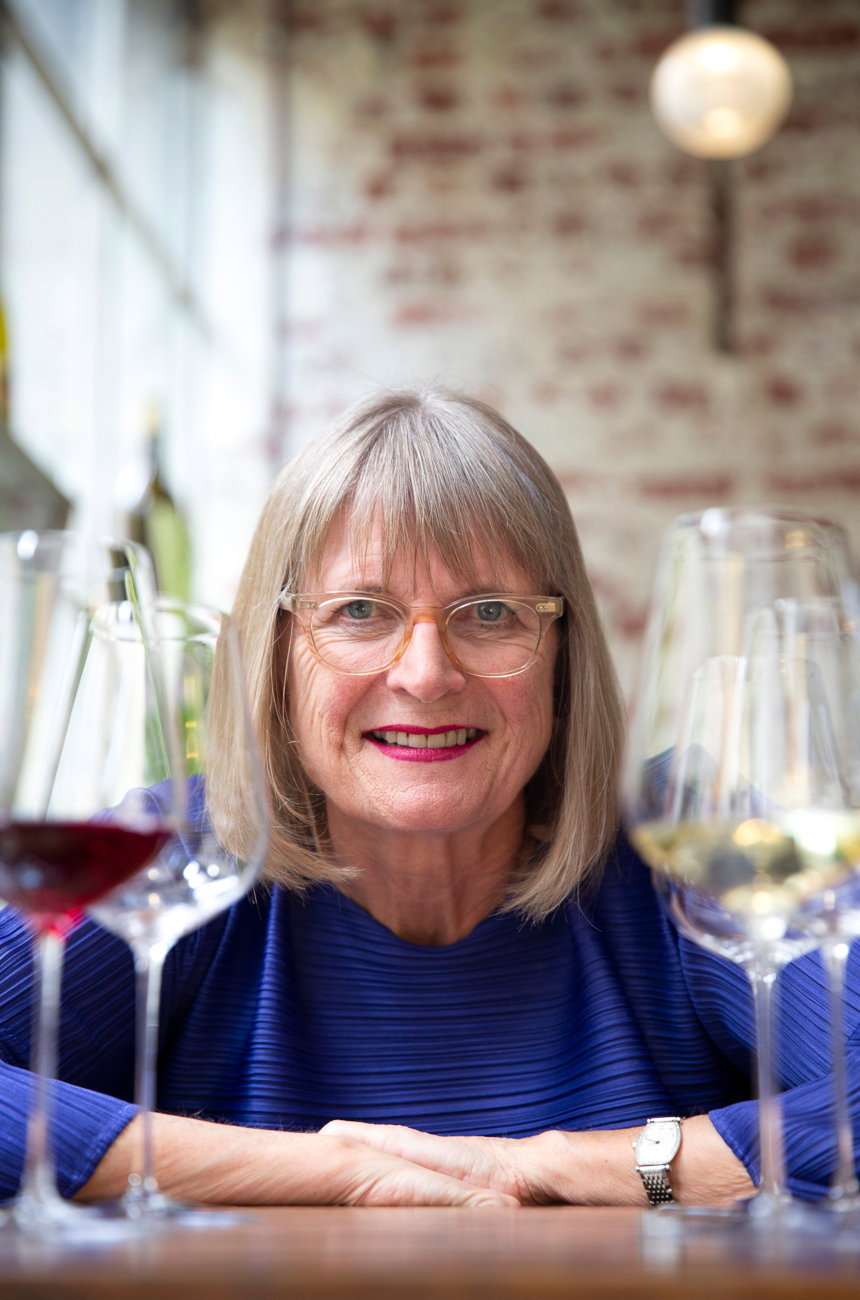
Harding’s involvement is especially important for readers who use the Atlas as a working tool. Since the 7th edition, she has been associated with map revisions, and the 9th edition’s 240 revised and updated maps make that work central rather than peripheral. The book’s authority rests not only on the famous names on the cover, but on the accuracy of small visual decisions: where a boundary sits, how a region is framed, what is included, and what is left out.
Johnson’s presence keeps the edition linked to 1971, when the first World Atlas of Wine appeared. That continuity matters because wine changes slowly and then suddenly. Appellations codify tradition, yet plantings, reputations, and climate conditions keep moving. A reference that has followed those changes for more than five decades carries a different weight from a new survey, however polished.
Robinson’s five-edition arc gives the new volume another kind of continuity. From the 5th edition in 2001 to the 9th in 2026, the Atlas has had to absorb the broadening of the wine world: new regions, new commercial routes, new anxieties, new travel patterns. The 9th edition’s all new photography gives that evolution a visual register, but the maps remain the discipline.
The use of the World Atlas of Wine is not passive reading. It sits open beside a bottle, a list, an allocation note, or a travel plan. You look up the place, then return to the glass with better questions.
Consider how collectors actually buy now. A release email may name an appellation, a subregion, a grower, and a parcel, but it rarely gives the full geographic relationship between them. A restaurant sommelier may offer a Lebanese wine alongside Rhône varieties, or a British Columbia bottle beside a Loire selection, but the pairing only becomes intellectually satisfying when you can place the wine on a map and understand the conditions around it.
The 9th edition’s climate data gives that exercise sharper edges. A collector thinking about cellar windows still needs producer track record, vintage character, storage, and bottle format. Yet regional temperature movement belongs in the same conversation. If the Atlas helps you ask one better question before you buy, about site, heat, exposure, or regional change, it has already earned its place on the desk.
There is also a travel advantage. Wine-focused travel rewards the prepared. Walking into a tasting room in Marlborough, the Yarra Valley, Alentejo, Chile, or the Central Coast with a working sense of geography changes the conversation. You do not have to perform expertise. You simply know where you are.
The new edition also belongs in the trade cellar, the room where sommeliers train, buyers compare regions, and educators try to give students a sense of place before they have the budget to see it. Five million copies sold in 16 languages explains why the Atlas has become shared reference material across wine cultures. The 9th edition updates that shared language for a warmer, wider wine world.
For now, the practical details are clear: the 9th edition of The World Atlas of Wine, by Jancis Robinson, Hugh Johnson, and Julia Harding MW, is published by Hachette UK/Octopus Publishing Group on 24 September 2026 in the UK and 6 October 2026 in the US. The next thing to watch is how quickly its new maps begin appearing beside allocation lists, tasting flights, and the itineraries of travelers who prefer to understand a region before the first cork is pulled.
Get the App
Take the shortlist into the En Primeur Club app for concierge access, saved places, and the next step after discovery.
Get Exclusive AccessMore from the editors