Mount Woodson Trail
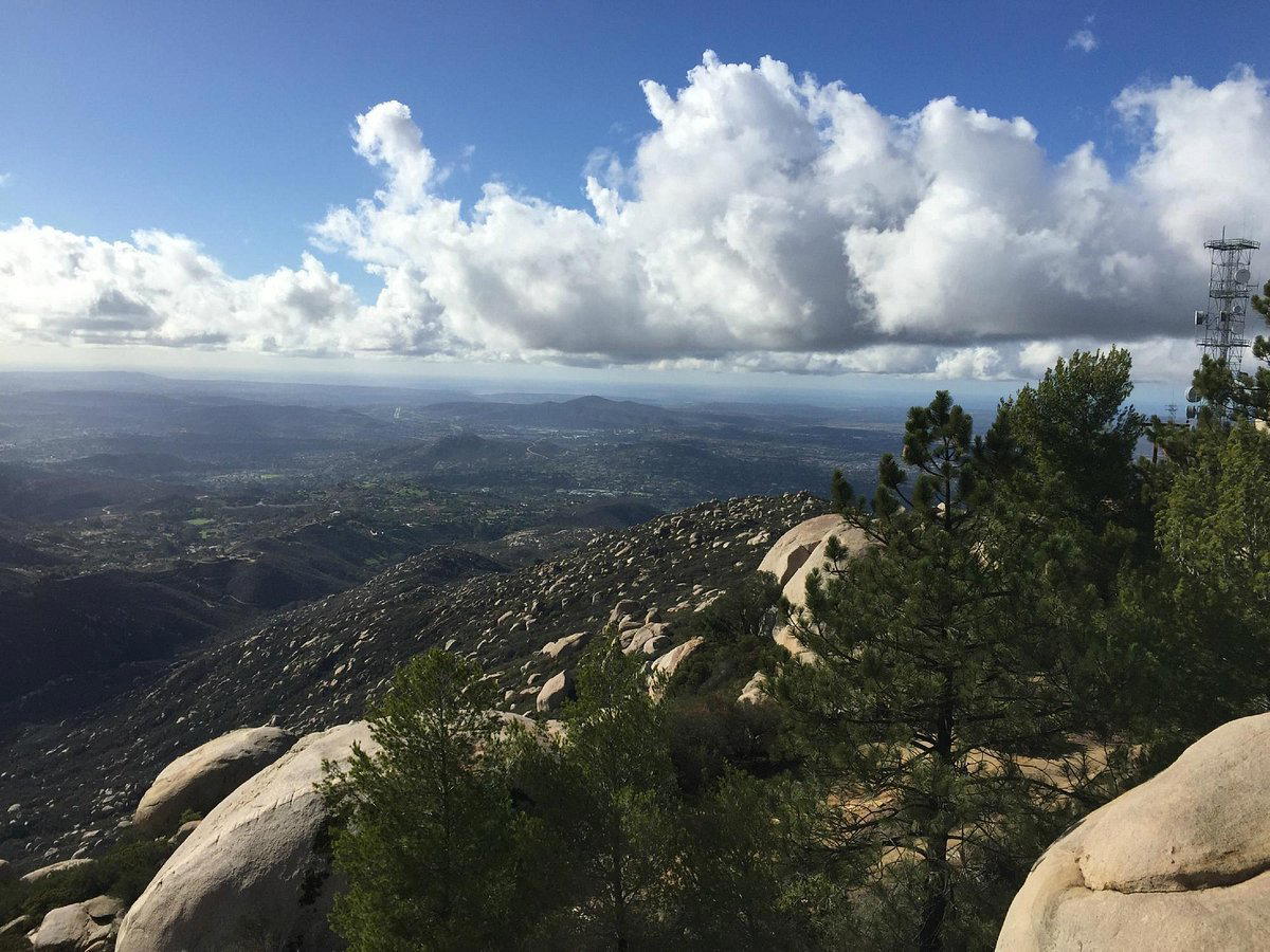
Mount Woodson Trail in Poway, California is one of San Diego County's most photographed hiking routes, known for the dramatic granite boulder formations that define its upper ridgeline. The climb to the summit rewards with panoramic views across the county and access to the famous Potato Chip Rock formation. Best approached on weekdays to avoid weekend crowds, the trail suits moderately fit hikers with proper footwear.

Pearl is the En Primeur Club membership app, where members save venues, book tables and use the concierge.
Granite, Exposure, and the Architecture of the San Diego Backcountry
San Diego County's inland range rarely announces itself with the drama of coastal scenery, yet the granite-studded ridgeline above Poway makes a compelling case for looking east rather than west. Mount Woodson Trail rises through chaparral and exposed rock to a summit that sits at roughly 2,894 feet, where the geology does what no designed lookout platform could replicate: it places you at the edge of enormous, weather-sculpted boulders with unobstructed sightlines across the county. The physical architecture of this route is the story, not the foliage, not the facilities, and not any particular amenity at the trailhead.
The trail belongs to a broader tradition of Southern California granite hikes, a category that also includes Joshua Tree's rock formations and the Cuyamaca Rancho peaks further southeast. What separates Mount Woodson from those alternatives is the specific character of its boulder field: massive, rounded, stacked formations that geologists attribute to millions of years of spheroidal weathering, a process that peels concentric shells from the rock over deep time. The result is not a jagged alpine ridge but something closer to a sculptural landscape, as though the hillside had been worked by a hand with a preference for curves over angles. For hikers arriving from design-conscious travel elsewhere, whether that means Ambiente, A Landscape Hotel in Sedona or the cliff-edge compositions of Amangiri in Canyon Point, the visual grammar here will feel familiar: terrain as a form of environmental design.
The Route and Its Physical Logic
The standard approach begins at the Lake Poway Recreation Area parking lot, with the full out-and-back run covering approximately 8 miles round trip and accumulating around 1,600 feet of elevation gain. Those figures place it firmly in the moderate-to-strenuous tier for recreational hikers, demanding enough that it filters out casual visitors but accessible enough that fit hikers without technical experience can complete it comfortably. The trail surface transitions from compacted dirt and gravel in the lower sections to open granite slabs near the summit, where route-finding requires reading the painted trail markers on the rock rather than following an obvious path through vegetation.
Upper section is where the design logic of the landscape becomes most legible. Hikers move between and around boulders rather than simply ascending a slope, which creates a spatial experience closer to moving through a structure than climbing a hill. Individual rock formations create natural frames for the views beyond, so what you see shifts with each turn rather than opening onto a single fixed panorama. This quality, the sequential revelation of the landscape, is one the route shares with trails in wilderness areas significantly more remote than Poway, including those accessible from properties like Post Ranch Inn in Big Sur or Sage Lodge in Pray in Montana.
Potato Chip Rock: A Formation That Has Become Its Own Subject
No account of Mount Woodson Trail avoids the Potato Chip Rock phenomenon, so it is worth addressing it directly. The formation, a thin horizontal slab of granite cantilevered over open air near the summit, has accumulated hundreds of thousands of social media images over the past decade and transformed a moderately known local hike into one of the most photographed trail features in California. The queue for a photograph on the rock can stretch to 45 minutes or longer on peak weekend mornings, which fundamentally changes the character of arriving at the summit.
This dynamic is neither unique to Poway nor to outdoor destinations: premium experiences everywhere now contend with the gap between the experience itself and its documentation. The rock is genuinely arresting as a geological object, a demonstration of how long a cantilevered slab can survive before gravity and weathering claim it, and the view from it is substantial. But visiting on a Saturday in spring means the summit operates at capacity in a way that shifts its character from contemplative to social. Weekday mornings between Tuesday and Thursday, arriving before 8 a.m. substantially change the density of that experience.
Context Within Poway and San Diego County
Poway positions itself in regional marketing as "the city in the country," a phrase that describes something real about its geography: it sits inland from the coastal strip at the edge of developed San Diego County, with the Cleveland National Forest and open space preserves forming its eastern boundary. Mount Woodson Trail is the most prominent outdoor draw in that open space network, and for visitors building itineraries around Southern California's natural terrain, it fits naturally alongside coastal routes further west. Those planning longer California stays might combine the trail with time in Napa at Auberge du Soleil or Healdsburg at SingleThread Farm Inn, though the register is entirely different: granite chaparral against wine-country pastoral.
For the San Diego County region specifically, see our full Poway restaurants guide for dining options that complement a hiking-focused day in the area. After a full day on the trail, the caloric math tilts decisively toward a proper meal.
Planning the Visit
Lake Poway Recreation Area charges a parking fee for non-Poway residents on weekends, typically a modest day-use rate, though visitors should confirm current fee schedules directly with the City of Poway Parks and Recreation Department before arrival, as these figures are subject to seasonal adjustment. Trail access is managed through the City of Poway, and the trailhead sits on California 67 as an alternative starting point for those who prefer a different approach gradient. The California 67 start is roughly 7 miles round trip to the summit and back, with slightly different character in the lower section.
Carry more water than the elevation gain suggests is necessary. Southern California chaparral generates significant heat gain in summer and on exposed south-facing slopes, and the granite surfaces amplify that effect substantially. The trail has no shade structures and minimal shelter once above the tree line, which begins earlier on this route than on wooded alternatives. Those accustomed to mountain hiking in more northern or forested contexts should recalibrate expectations around sun exposure and temperature gradient. Trekking poles are useful on the granite slab sections near the summit, particularly on the descent when surfaces may be dusty.
Travelers who calibrate outdoor experiences against properties built around landscape immersion, such as Canyon Ranch Tucson, Blackberry Farm in Walland, or Alpine Falls Ranch in Superior, will find Mount Woodson Trail a credible counterpart in the Southern California context: terrain with genuine physical and visual consequence, delivered without the infrastructure of a resort setting.
Side-by-Side Snapshot
| Venue | Price | Awards |
|---|---|---|
| Mount Woodson TrailThis venue (the venue you are viewing) | Not listed | Not listed |
| Aman New York | Not listed | 3 Michelin Keys · World's 50 Best #87 |
| Amangiri | $1,000–1,500 | 3 Michelin Keys · World's 50 Best #45 |
| Hotel Bel-Air | $750–1,000 | 3 Michelin Keys · World's 50 Best #57 |
| The Beverly Hills Hotel | Not listed | 3 Michelin Keys · World's 50 Best #65 |
| The Carlyle, A Rosewood Hotel | $1,500–2,500 | 2 Michelin Keys · World's 50 Best #64 |
Continue exploring
More in Poway
Hotels in Poway
All hotels in Poway →












Details
- Scenic
- Rustic
- Weekend Escape
- Mountain
Natural outdoor setting with serene mountain atmosphere.